Turkmenistan is a fascinating and mysterious country that leaves you wanting to learn more. Here’s a look at some of the places tourists can visit.
Darvaza Gas Crater or The Gates of Hell
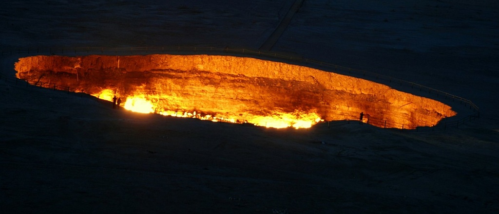
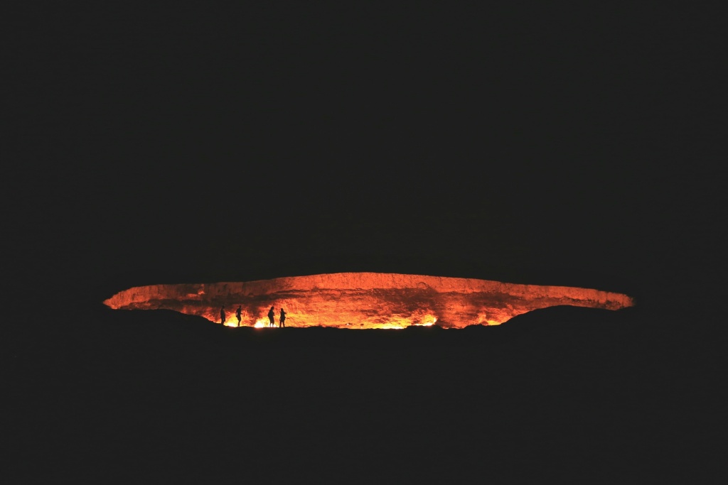
The Darvaza Gas Crater is located in the village of Derweze in the Ahal Region of Turkmenistan. This man-made crater was created in 1971 during Soviet natural gas exploration. The story goes that Soviet geologists drilled a hole and discovered a cavity filled with natural gas. The ground beneath the drilling rig collapsed, forming the massive crater we see today. Fearing that the gas might be harmful to the nearby villages, scientists set the hole on fire, hoping it would burn out in a few days. However, the flames have been burning ever since, for over 50 years now.
The Darvaza Gas Crater has a diameter of about 70 meters and a depth of 20 meters. The fire is most intense at night, illuminating the desert sky and creating an otherworldly atmosphere. The crater is also surrounded by a ring of fire, where flames erupt from the ground, adding an eerie beauty to the site.
This natural phenomenon, like a portal to the underworld, creates an aura of mystery and allure, drawing tourists from all over the globe.
Yangykala Canyons
One of the most picturesque natural sites in Turkmenistan, the Yangykala Canyons are located 165 kilometers north of Balkanabat and 160 kilometers east of Turkmenbashi.
About 5.5 million years ago, when the now-vanished Tethys Sea still existed, these cliffs were carved out of limestone by the relentless forces of nature. The mighty Amu Darya River, which once flowed into the Caspian Sea, left behind many marvelous landscapes, with the Yangykala Canyon being one of them.
Kow-Ata Underground Lake
Not far from Ashgabat, just 60 kilometers to the west, lies the famous Baharden Cave, which houses the equally renowned Kow-Ata Underground Lake. The name of the lake translates to "father of caves". The fame of this place is linked not so much to the beauty of the underground scenery as to the healing properties of its water.
The descent into Baharden Cave begins with a steep staircase, making a flashlight almost necessary. At the bottom, 60 meters down, a small part of Kow-Ata Lake is visible. The depth of the lake ranges from 8 to 14 meters.
The healing water of Kow-Ata Lake contains 38 elements, including iodine, magnesium, iron, bromine, potassium, sodium, sulfate, and others. Bathing in this water improves blood circulation, helps fight ailments like rheumatism and skin and kidney diseases, calms the nervous system, and positively affects the entire body. The recommended time in the water should not exceed 20 minutes. There is a legend that during the Parthian Kingdom, mortally wounded rebel slaves were healed here.
Old Nisa
Located 18 kilometers west of Ashgabat, at the foot of the Kopetdag Mountains, lies Nisa — once the mighty capital of the Parthian Empire, which thrived at the turn of the 1st millennium BC and the 1st millennium AD.
In the 3rd century BC, New Nisa served as the political center of Parthia, while Old Nisa, perched on a hill, functioned as the royal residence. Life thrived in these places, history was made, and grand palaces and temples bore witness to the empire's former glory.
In 2007, Nisa was included in the UNESCO World Heritage list as a priceless historical and cultural monument. The architectural style of the city was influenced by indigenous traditions as well as the achievements of the Greco-Roman world. This unique blend of local and Hellenistic styles created a distinctive architectural ensemble that continues to captivate travelers today.
Kunya-Urgench
Kunya-Urgench, also known as Köneürgenç, is an ancient city, first mentioned in the 3rd-1st centuries BC. It is even referenced in the Avesta, the sacred book of Zoroastrianism.
All the landmarks of Kunya-Urgench are located in the Old Town and are part of the UNESCO World Heritage list. Once a bustling stop on the Great Silk Road, the city today preserves several structures from the 11th-16th centuries. The Kutlug Timur Minaret, built in the 14th century, is considered the tallest in Central Asia, standing at 60-62 meters. Once part of a mosque that was destroyed, this minaret remains a majestic sight.
The 14th-century mausoleum where the daughter of Uzbek Khan, Tyurabek Khanum, is buried is notable for its dome mosaic, featuring floral and star motifs that are said to be unparalleled. The Kyrk Molla Fortress is the oldest monument in Kunya-Urgench, dating back to the 3rd-2nd centuries BC. In the 13th century, the city's ruler planned to build a palace for scholars here, hoping that 40 000 mullahs would work within its walls.
Other architectural monuments to explore in Kunya-Urgench include the medieval city of Ak-Kala, the Mamun Minaret built in the 10th-11th centuries, the mausoleum of Khorezmshah Il-Arslan from the 12th century, and others. Not many historical sites have survived, so each one is worth a visit.
Dinosaur Plateau
In the far east of Turkmenistan, in the Kugitang Mountains at an altitude of 1500 meters, lies one of the most astonishing natural attractions — the Dinosaur Plateau. This is actually a large limestone slab on a mountain slope, reachable by a half-hour journey from the small village of Khodjapil. The world first learned about this place in 1980, and it quickly became famous as the largest repository of dinosaur tracks.
The plateau itself is a platform measuring 200 by 80 meters, tilted at a 17-20 degree angle. Surrounding this exposed limestone section are ordinary earthen slopes covered with bushes and grass, while on the elongated slab are scattered sequences of enormous footprints. The fossilized depressions range in size from 20 to 70 centimeters, belonging to three types of Jurassic dinosaurs that have yet to be precisely identified.
Nohur
Four hours' drive from Ashgabat, in the western part of the Kopetdag Range, lies an extraordinarily beautiful and culturally rich region inhabited by the Turkmen mountain tribe of Nohur, who have preserved their distinctive culture, traditional crafts, and unique architecture through the centuries.
The two settlements — Old and New Nohur — have become attractive tourist destinations and are included in the list of "100 Most Romantic Places in the World". The houses in these villages are two-storied and built in the traditional architectural style using mountain stone. Around the settlements are gardens and orchards that the mountain people cultivate in hard-to-reach places at altitudes of 1600-1800 meters above sea level. Near the village, you can find the Nohur Waterfall, the highest point of the Kopetdag — Uchqui. Nearby is also the place where wishes come true — Gyz Bibi.
Ancient City of Merv
The Merv Oasis is one of the oldest regions in Central Asia, pioneering irrigation. So, it's not surprising that one of the largest cities of the ancient world, Merv, grew here. The first written mentions of the city appear in Avestan chronicles around the 8th-6th centuries BC. Chroniclers used colorful epithets, calling it "the soul of the king", "the mother of the cities of Khorasan" and "the city on which the universe rests." Here lived and worked such great medieval thinkers as Omar Khayyam, As-Samani, and Imamaddin-Isfahani.
Today, the ruins of Merv include at least five ancient settlements: Erk-Kala, Gyaur-Kala, Sultan-Kala, Abdullakhan-Kala, and Bayramalihan-Kala. Most are heavily damaged, with some reduced to mere mounds of earth, but even with these losses, Merv remains one of the most unique historical monuments.
In modern times, the ancient city of Merv is listed as a UNESCO World Heritage site as the best-preserved ancient center of the Great Silk Road.


